Every waterfall, fjord, glacier, lava field, hot spring and saga site in Iceland — written about, photographed, and mapped by people who have been driving these roads and walking these slopes for decades.
Nothing here is auto-generated. Every description is hand-written. Every photograph is hand-picked — many shot by the authors themselves on the road, others sourced and licensed with care. Coordinates are verified on the ground. Many places carry their saga, folk story, or local myth in the same card as the practical information — because half of why a place matters in Iceland is the story that happened there. Where the geography deserves it, there might be a drone clip too.
Underneath sits a road network classified by what you're driving. From a city rental on the Ring Road, through gravel and tertiary back roads, into 4×4 territory and the F-roads, into superjeep country and the deep highland — pick your vehicle and only see what you can actually drive. Every F-road carries its grade. Every unbridged river ford in the highlands is on the map with its current condition. Closures from Vegagerðin flow in live. Built for offline first — pinch the map at the foot of Vatnajökull and you'll still see Hvannadalshnjúkur and the saga of Öræfi without a bar of signal.
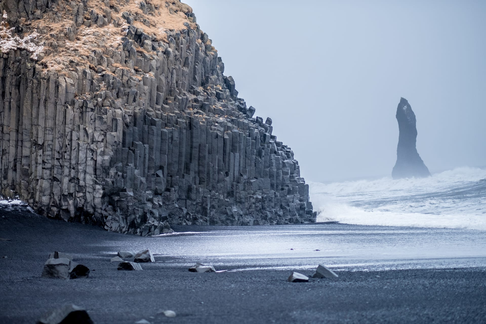
1,000+ POIs, with stories
Hand-curated landmarks, waterfalls, hot springs, museums, lighthouses and roadside oddities — each with a description short enough to read at a viewpoint, long enough to know what you're looking at. Many carry the saga, folk tale or local myth attached to the place. Occasional drone footage where the geography rewards flying it.
A road map for every vehicle
The full road network of Iceland, curated and classified by surface, grade and vehicle access. Ring Road through gravel through F-roads through superjeep-only tracks. Pick the car you're driving and only see what's drivable — no more guessing whether a dotted line on a generic map will eat your rental insurance.
Every ford, every closure
Every unbridged river crossing in the highlands is on the map, with its current condition pulled from Vegagerðin. Glacier-fed crossings carry a separate warning for melt-rise risk. Road closures flow in live. Plus 200+ legal campsites and hiking trails enriched with elevation gain and FÍ trail copy.
Works without signal
The map, every POI description, every saga and the full road network are baked into the app. Pinch the map at the foot of Vatnajökull or deep in the Kjölur highland and you'll still know where you are and what you're looking at, without a bar of signal. Photo galleries, live Vegagerðin road closures and current ford conditions refresh when you're back in coverage.